
Gaussian Splats: Beautiful 3D Models That Help Organizations See, Understand, and Act

Modern organizations do not need more data just for the sake of having data. They need clearer answers, better visuals, stronger documentation, and faster ways to understand what is happening across the real world.
That is where Gaussian splats are becoming extremely valuable.
At FinBee TAC, we help assessors, governments, and corporations turn complex real-world sites into clear, visual, and useful geospatial intelligence. Gaussian splats are one of the newest ways to create beautiful, realistic 3D models that make properties, infrastructure, land, and project sites easier to understand.
These models are not just impressive to look at. They help teams make better decisions.
What Are Gaussian Splats?
Gaussian splats are a new type of 3D visualization that can recreate real-world scenes with a high level of visual realism. Instead of relying only on traditional hard-surface 3D models, Gaussian splats use millions of small, intelligent 3D points that hold information about color, shape, transparency, size, and lighting.
When these points are combined, they create a smooth and realistic 3D scene that can be viewed from different angles.
The result is a model that feels more natural and lifelike than many traditional 3D models. Buildings, trees, roads, terrain, structures, fences, equipment, and site features can appear with impressive depth and detail.
For decision-makers, that matters.
A realistic 3D model can communicate site conditions faster than a flat image, spreadsheet, report, or technical drawing alone.


Why Gaussian Splats Matter
Many organizations are responsible for managing land, buildings, infrastructure, and assets across large areas. The challenge is not just collecting information. The challenge is making that information easy to understand and easy to use.
Gaussian splats help bridge that gap.
They allow teams to visually explore a real-world location in 3D, giving them a better sense of context, condition, layout, access, surrounding improvements, and physical change.
For assessors, this can support property review, improvement verification, and condition documentation.
For government agencies, this can support planning, zoning, public works, GIS, emergency management, infrastructure review, and public communication.
For corporations, this can support asset documentation, site planning, development review, facility management, environmental monitoring, and project communication.
The value is not just the model.
The value is what the model helps people understand.

Better Property and Asset Understanding
A realistic 3D model gives teams a clearer way to review physical conditions without relying only on disconnected photos or written descriptions.
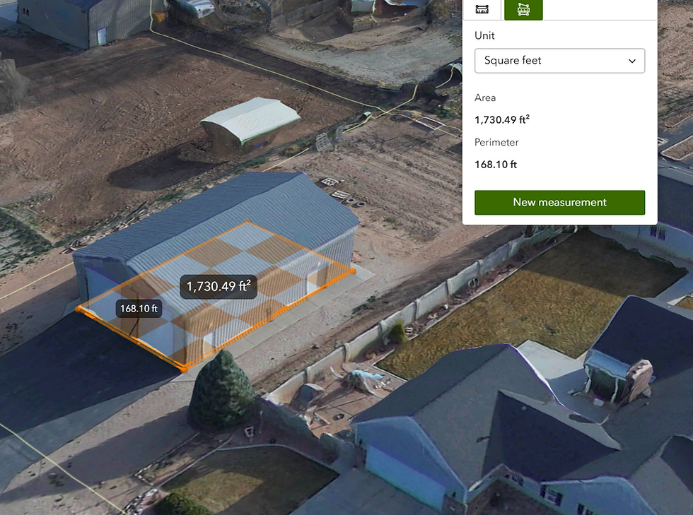
For an assessor’s office, that can mean a better view of structures, additions, land use, access, terrain, and property characteristics. Instead of trying to interpret a site from limited imagery, staff can view the property in a more complete 3D environment.
For GIS and government departments, Gaussian splats can make assets easier to visualize. Roads, drainage areas, public facilities, utility corridors, buildings, and land features can be viewed in context with the surrounding area.
For corporations and project teams, a realistic model can create a digital record of a site at a specific point in time. That record can help with planning, internal review, change tracking, documentation, and communication between departments.
When people can see the site clearly, they can make better decisions with more confidence.

More Effective Communication
One of the biggest benefits of Gaussian splats is communication.
Technical data is powerful, but not every stakeholder reads GIS layers, CAD drawings, survey files, or engineering documents the same way. Elected officials, department heads, property owners, executives, contractors, and the public often need something more visual and intuitive.
Gaussian splats make complex sites easier to explain.
A realistic 3D model can help show existing conditions, project constraints, access issues, terrain, structures, surrounding development, and visible changes. This can be useful in meetings, presentations, public discussions, planning reviews, and internal decision-making.
Instead of asking people to imagine the site, you can show it to them.
That creates alignment faster.
Supporting Better Decisions
At FinBee TAC, we believe geospatial products should lead to practical outcomes.
A beautiful 3D model is valuable because it helps answer real questions:
What is currently on the site?
What has changed?
Where are the visible improvements?
How does the land relate to nearby infrastructure?
What assets exist in this area?
How can departments better understand the same location?
How can we communicate this project more clearly?
Gaussian splats can help organizations answer those questions visually. They provide a more realistic way to review properties, infrastructure, land, and development areas.
For assessors, this can help with property intelligence.
For governments, this can help with operational awareness.
For corporations, this can help with site and asset understanding.
The outcome is better clarity.
Gaussian Splats and Professional Geospatial Workflows
Gaussian splats are powerful, but they are not a replacement for every type of geospatial deliverable.
There is an important difference between a visually realistic model and a certified survey, engineered surface, legal boundary, or measurement-grade dataset. For professional use, the right workflow still matters.
That is where FinBee TAC’s approach is different.
We do not look at Gaussian splats as a standalone novelty. We look at them as one tool inside a larger geospatial intelligence workflow. Depending on the project, they can be combined with high-resolution imagery, GIS data, 3D models, point clouds, CAD support, site documentation, and professional mapping processes.
The goal is not just to create something beautiful.
The goal is to create something useful.
Why Realistic 3D Visualization Is Becoming More Important
Organizations are managing more data than ever before. But more data does not automatically mean better understanding.
Realistic 3D visualization helps turn large amounts of site information into something people can actually use. It gives teams a shared visual reference. It helps reduce confusion. It helps departments communicate. It helps decision-makers understand real-world conditions without needing to be technical specialists.
For counties and local governments, this can support more efficient internal review.
For assessors, it can improve property context and visual verification.
For corporations, it can support better project planning, asset documentation, and stakeholder communication.
Gaussian splats are part of a larger shift toward digital site intelligence: realistic, visual, accessible information that helps organizations understand the physical world more clearly.
FinBee TAC’s Focus
FinBee TAC helps assessors, governments, and corporations create practical geospatial intelligence from real-world data.
Our work is focused on outcomes:
Clearer property understanding.
Better asset documentation.
Stronger visual communication.
Improved site awareness.
More useful 3D visualization.
Better support for planning, review, and decision-making.
Gaussian splats are exciting because they make 3D models more realistic and easier to understand. When used correctly, they can help organizations move from simply collecting data to actually seeing and understanding the places they manage.
See the Real World More Clearly
Beautiful 3D models are more than visual products. They are tools for understanding.
With Gaussian splats, organizations can view properties, infrastructure, land, and project sites in a way that feels clear, realistic, and intuitive. This helps teams communicate better, document conditions, review changes, and make more confident decisions.
At FinBee TAC, we use advanced geospatial visualization to help clients see the real world more clearly — and turn that clarity into action.


Comments